Sunday was a lovely day, with clear cool skies and temperatures warming into the 60s. We were in a historic state park, new to us, on a loop trail with lovely lake views. The trail was beautifully maintained, with reasonable occasional ascents and descents. Folks we met on the trail were courteous and enjoying themselves. So why am I so angry as I’m writing this post?
I think it’s because I’m thinking back farther than just a few days. Our experience this past weekend at Booker T. Washington State Park in Chattanooga, Tennessee was excellent. Other than the visitor center being closed due to COVID-19, our experience was much like it is at any Tennessee state park — plenty of parking, well-maintained facilities, well-marked trails, attractive scenery, all available at no entrance fee. We were made to feel welcome…but more about that later.
Booker T. Washington State Park is on Chickamauga Lake, one of the impoundments of the Tennessee River. Started in 1938 as a TVA reservation, the park is named for the black American leader. A prominent voice in the early civil rights struggle, Washington was born into slavery and worked his way after the Civil War into college, eventually founding the Tuskegee Institute (now Tuskegee University) in Alabama at the age of 25. Through his work at Tuskegee, he became nationally known as a spokesman for education of freedmen and their descendants, aiding in the development of other schools. He came to represent a certain viewpoint that the best route forward for his race was to submit to white political rule in a segregated society, but to advance by receiving basic education and vocational training and being granted due process of law. This approach was known as the Atlanta compromise, as outlined in a speech by Washington in 1895. Given our modern sensibilities this may seem pretty weak, but it was the starting point for the evolution of more ambitious views of civil rights. Though he is known for his “go along to get along” views, Washington secretly financially supported court challenges related to segregation and voting registration. His influence waned after 1915 as other civil rights leaders such as W.E.B. Du Bois rose in prominence.
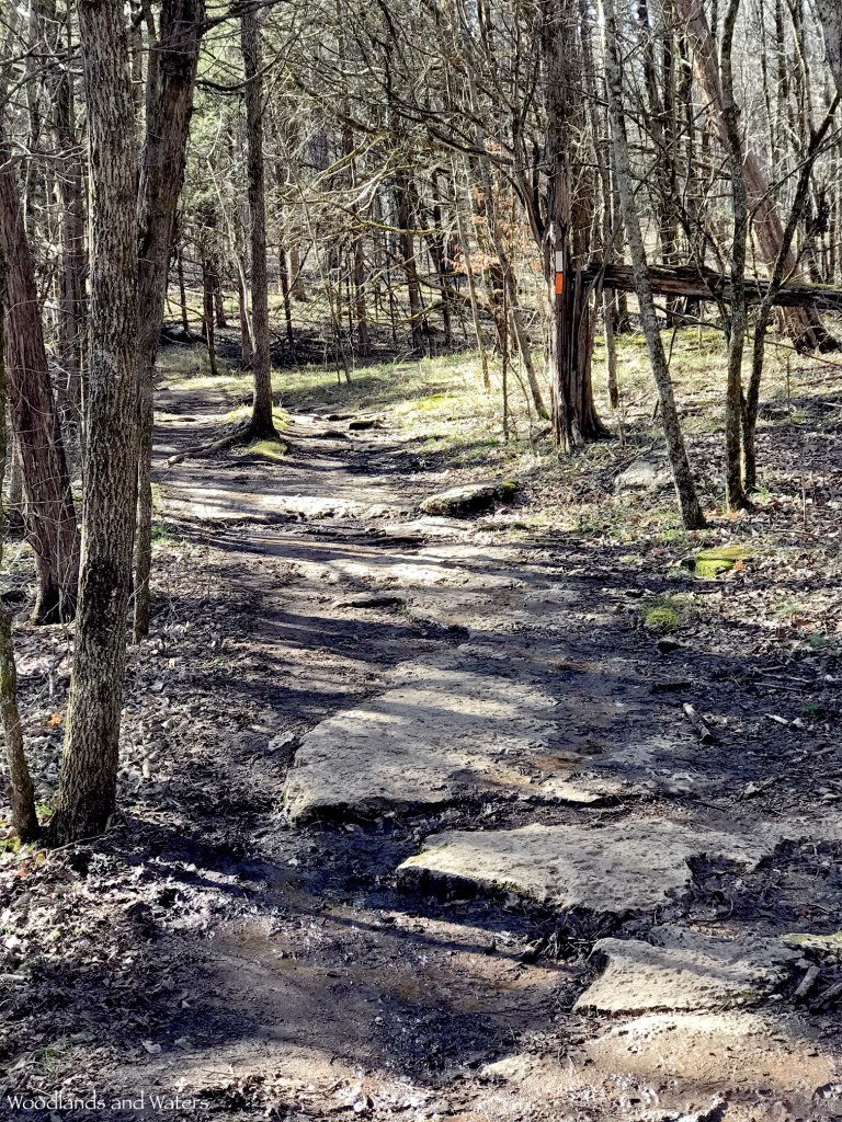
The state park has a hiking/biking trail system of around 8.5 miles on a peninsula sticking out into Chickamauga Lake on the north end of the park. The trail system consists of a nature trail loop, which intersects an outer loop trail of 3.9 miles. Two inner loop trails are inside the outer loop, so you can construct a number of hikes of varying distances. We opted to hike the Outer Loop trail, which is most quickly reached by a .3 mile segment of the Nature trail. We parked in the paved lot next to Pavilion 1A. The Nature trail begins at the north end of the parking lot next to a kiosk. There are restrooms and a playground uphill to the left, as well as some picnic shelters.
After passing the kiosk, the trail turns to the right and heads into the woods. Almost immediately there are great views of a long lobe of the lake stretching from the main body to the northeast, with easy access to the rocky shore. In 0.05 miles, the trail forks, with both forks seemingly heading in the same northeastern direction. The Nature trail is a loop, so you can choose to go clockwise or counterclockwise. The clockwise option passed closest to the lakeshore, so we opted to go that way. The trail is blazed with blue paint, and is never really labeled as the Nature Trail, but it matches the park’s trail map, in which the Nature Trail is marked in alternating green and blue dashes. Though we never saw any exhibits or labeled trees or plants, later on this loop there is a side trail to something that looks like an outdoor classroom.


The trail has a natural treadway, and this section of the Nature trail heads northeast for .3 miles along the lakeshore. There are several side trails down to the water, and down one of them we saw a great blue heron taking in the view. After we startled it into flying to the opposite shore, we popped down to the bank to get photos up and down the cove.


The trail appears to split at one point along this stretch, but we continued along the path that hugged the shore. It’s a little confusing, as this part of the loop trail is pinched together without actually intersecting, so sometimes the other side of the loop trail is literally next to the footbed along the lake. Just stick to the trail closest to the lake and you’ll be fine. At .3 miles, we reached the intersection of the Nature trail and the Outer Loop trail, which is also blazed in blue. The intersection is marked with a tree with double blazes. We opted to continue hiking clockwise on the Outer Loop, so we headed to the left.


This segment of the Outer Loop heads northeast briefly to the end of the cove, then turns southwest to follow the north shore. There are a couple of plank bridges in this area, as a small feeder creek flows into the cove. The single-track trail has very little elevation change in this section, since it’s only a few feet from the water, but there are a couple of large dips where a drainage has eroded the trail. They were easy to cross on foot, and would probably be fine on a bike but you’ll need to watch out for them.


One of the quirks of hiking along the shore of a cove is that you may see the starting point of your hike across the water. Our friend the heron was still hanging out on this side of the cove, but there was too much underbrush to get a good photo. At roughly .65 miles from where we started on the Outer Loop, we rounded the peninsula and started heading north, with the main body of Chickamauga Lake off to the left. There’s a small overlook here, where we paused briefly to take photos.


Though the trail surface didn’t change here, its elevation certainly did. The climb is gradual, with an elevation gain of 70 feet over the next half mile or so. Chickamauga Lake is visible through the trees, but even in the winter the views are somewhat obstructed. We passed through an area where there had been a large blowdown, but here and everywhere on this hike we saw excellent trail maintenance, never once having to step around or over obstacles. We reached the first intersection with the Inner Loop 1 trail 1.15 miles from where we started on the Outer Loop. This junction was very well marked, with a terrific wooden version of the trail map, complete with a “here” marker so you could place yourself on the map.


You’ll notice from the trail map that the Inner 1 and Inner 2 loops actually have two junctions with the Outer Loop trail. We reached the second junction for Inner Loop 1 about 150 feet down the trail. The next segment of the Outer Loop reached the highest elevation on this hike, about 800 feet, so the trail tended uphill when heading north. The gain in elevation didn’t help much with the lake views. I noticed English ivy climbing trees here, which reminds me to mention that we did see quite a few examples of non-native plants such as privet and nandina. At least the nandina gave the woods a pop of color.


Nandina 
English ivy
Our next landmark, at .6 miles from the Inner Loop 1 intersection, was the two intersections with the Inner Loop 2 trail. This intersection is at the northernmost end of the peninsula, where there’s a thoughtfully placed bench that allows you to rest and view the lake to the left and a small cove to the right. We took a brief break here before continuing southeast toward the end of the cove.


After reaching the end of this small cove, the Outer Loop continues away from the water, then turns east. We had not noticed a change in background color on the trail map, so it was a mild surprise when the Outer Loop actually left state park property and continued onto TVA property. The proximity to TVA property isn’t surprising, as the park was originally developed by the TVA and was leased to the state until 1950. The trail climbs briefly in this area, and features three spur trails that connect to Solitude Drive. The spur trails aren’t on the trail map, but they are prominently marked on the trail itself, with the first and third spurs displaying those excellent wooden maps. After the first spur trail, the Outer Loop trail widens considerably as it follows an old road. After the second spur trail, Outer Loop returns to single-track, winding through a gradual descent as it re-enters the state park.


This last segment of the Outer Loop trail largely parallels Solitude Drive, crossing a couple more plank bridges before returning to the junction with the Nature loop trail. To be sticklers, we took the split to the left so that we would complete the Nature trail loop. In retrospect, I wouldn’t recommend this, as this part of the Nature trail closely parallels Champion Road, which is quite a bit busier than Solitude Drive. It’s also longer, as the eastern portion of the loop is .75 miles back to the trailhead by Pavilion 1A, as opposed to .35 miles if you backtrack along the part of the loop next to the lake. If you parked at the pool (there’s a second trailhead there) then it’s slightly shorter to take the split to the left. We went left just to complete the loop, but there weren’t any remarkable features there except a couple of banked turns for bikers. In fact, this segment was one of those annoying ones that winds unnecessarily over flat ground just to give bike riders a little more mileage.


Speaking of bike riders, I understand that these loops are very popular in the Chattanooga biking community. We only saw one biker during our hike (she lapped us three times, I think). The trail maintainers have done a great job of making the Outer Loop bike-friendly, and it’s likely that they’ve done the same for the inner loops.


We completed the Nature trail loop and rejoined the trail back to the kiosk, for a grand total of 3.88 miles according to our GPS track. We made pretty good time on this trail by our standards, finishing in about three hours. Fitter people who don’t stop to take photos will make even better time. On our way out, we stopped by the fishing pier, where Ruth had earlier noticed some historical markers. We paused to learn more about the CCC and Booker T. Washington.


So why I am so worked up about this park? I selected it for a hike during Black History Month for a reason — Booker T. Washington State Park is one of two state parks originally built in Tennessee as black-only parks. Generally speaking, state park development in the South only really took off in the Depression era, as the Federal Government pumped money into the states for grand public works projects. The TVA built recreational facilities, the CCC and WPA built state and national parks, and it was a boom time for public recreation — if you were white. The South was still in the grip of Jim Crow laws enacted during Reconstruction, reinforced by the dreadful Plessy vs. Ferguson Supreme Court ruling in 1896 that established the “separate but equal” principle. As noted by William O’Brien in a 2007 article, “… the ‘equal’ provisions of such laws were never as stringently applied as were the ‘separate’ provisions, and the exclusion of African Americans from opportunities and activities available to whites was the norm.”
O’Brien later wrote a book, Landscapes of Exclusion: State Parks and Jim Crow in the American South (Amherst: University of Massachusetts Press, 2015) that explores this topic in more depth. One illustration in that book shows a map of the southeast with dots representing state park locations, with black dots for each park that had facilities available to African Americans from 1937 to 1962. I didn’t count every dot, but I’d estimate the ratio was about 1:10 overall. Tennessee had 2 parks for black use, with another 15 reserved for whites. Alabama had one park with some facilities for black use (which weren’t built until 1952-53), with another 8 or 9 for whites only. In 1954, in nine southern states there were 12 parks in existence or in the planning stage for African Americans — as compared to 180 white-only state parks.
Don’t make the mistake of thinking that those meager few parks and facilities for African Americans were built out of generosity of spirit. In most cases, those parks were built as “proof” of the feasibility of separate but equal facilities, in a cynical attempt to fool the courts into delaying the inevitable. It was no accident that when Alabama finally came around to adding black-accessible facilities to a state park, it selected a park in one corner of the state — the only Alabama state park to be named after a Civil War general. You won’t find any mention of this in Joe Wheeler State Park’s website or brochures. And when states built black-only parks or facilities, they were often in inferior locations with fewer amenities.
Southern states did eventually desegregate their parks — some by reluctant choice, some because of the passage of the Civil Rights Act of 1964. When forced to desegregate, some states quietly but unhappily complied (Tennessee is one example), and others angrily resisted, privatizing (Georgia) or closing (South Carolina) their parks. Tennessee was ahead of the curve, desegregating all state parks by 1962. Tennessee, to its credit, still operates its two formerly black-only parks (Booker T. Washington and T.O. Fuller State Park in Memphis) under their original names; North Carolina follows suit with Jones Lake State Park. All other formerly black-only parks are no longer in operation, at least as state parks. Some were sold, some were privatized, some were given to county and local governments, some were abandoned. Parks that had separate black and white amenities combined them, usually with no acknowledgment of their segregated pasts.
And here’s where it gets personal. It’s easy for historical events or movements to get pushed into the background if they happened before you were alive, especially if there’s no personal connection. Though Ruth and I were just infants at the time, during our lifespan black people weren’t welcome at the vast majority of state parks. They were shunted into fewer and inferior parks. Fortunately, that’s not the case anymore, but it speaks volumes about why African-American attendance in our parks is well below what you would expect, demographically. Ruth and I have often wondered about this, and now we know that black people in our generation in the South were either excluded from state parks, or their parents were. It’s not that I’m surprised that there was (and is) racism — I’m just furious at the stupidity of it, and at the cynicism of the politicians who grudgingly complied with public pressure, lawsuits, and legislation. They never thought they were wrong, and those are the people who destroy the world.
And this is when it really hit me. Back in December 2019, Ruth and I hiked an area of Joe Wheeler State Park known as the Multi-Use Trail (Ghosts of Picnics Past: Joe Wheeler Multi-Use Trail). This trail, on the south side of Wilson Lake, passes the ruined chimneys of a picnic pavilion, a collapsed gazebo, an abandoned bath house, and damaged and overgrown concrete picnic tables. We were confused about why the park would have abandoned a developed area. In that post, I wrote, “On the other side of the trail, remains of concrete picnic tables stood silent, with occasional grills and ruined water fountains dotting what was clearly an old picnic ground. At one time, it would have been a lovely picnic spot, with views of the river and the dam below. Long abandoned, it was haunted by the ghosts of picnics past.”
Now, unless I’m very much mistaken, I believe we were in the black-only portion of Joe Wheeler State Park, abandoned after the desegregation of the Alabama state park system. It’s known that at Joe Wheeler the black-only section of the park was on the other side of the river from the white-only section. Given that the lodge, the golf course, and the campground are on the north side of the Tennessee River, the south side is the logical location. Topo maps from 1957 show the buildings, dirt roads, and the picnic area; topo maps from 1936 do not show any buildings or dirt roads in that area.
We were standing among the relics of a shameful past — the only state park system facilities in Alabama made available to African-Americans prior to desegregation — and didn’t even know it.


UPDATE, 8 March 2021: Since publishing this post, I have acquired William O’Brien’s book Landscapes of Exclusion (mentioned above), which includes a “sketch plan of Joe Wheeler State Park” that shows the location of the “Negro Recreational Area.” Though my original post had an evocative ending, the truth is that I was indeed mistaken. The actual location of the black-only portion of Joe Wheeler State Park is on the east side of the First Creek embayment, on the north side of Wheeler Lake. It looks like the actual location is north of the present-day First Creek boat ramp, perhaps in the vicinity of the park’s Fisherman’s Cabin. I haven’t examined that particular section of the park, but other than the cabin there are no trails or amenities there now. It’s like the “Negro Recreational Area” never existed, which might be an even sadder end to this post.